Thursday 24 September 2015

Geology and land use

Switzerland's underground environment is highly varied. It is situated on a quiet tectonic zone even though the city of Basil was totally destroyed by an earthquake in 1356. The area that is now Switzerland was covered several times by a sea. Evidence of this can be seen in the Jura region where thick limestone layers have been formed. During the formation of the Alps, rock material was removed by erosion and it was deposited in front of the rising mountain range. As a result the geology around the Swiss Alps is highly diverse. 


Swiss land in used three main ways farming, forestation, housing or infrastructure. Agriculture is the most important use of territory in Switzerland. Farmland occupies over half of the Plateau area. Protection of forested land interfered with the farmland and this has caused much conflict of interests. This conflict was especially difficult like areas in the Plateau where urban areas and infrastructure have been reducing the amount of arable farming land.  The number of farms tend to decrease in the mountainous areas.  Swiss agriculture mainly includes, potatoes, sugar beets, wheat, barley, maize, oats and rye.


Forests cover about one third of Switzerland but this is decreasing year by year. Reforestation is really popular in the Alp regions as abandoned farmland naturally reoccupies itself with tree etc. Afforestation is also provided to provide protection against natural hazards such as landslides. 

The habitats in Switzerland are found mainly in the Plateau and along the main rivers and water sources. Housing and infrastructure grows increasingly in urban areas and also in the countryside but at the expense of the precious agriculture land. This is called suburbanisation. New roads are increasing the damage and loss of this farmland. Many people who work in the city tend to prefer to live in the countryside so therefore roads and construction must happen. These people take advantage of the cheaper land and better standard of life. In the past 12 years the areas for housing and infrastructure has grown to 25% while the population has only grown by 9%.

Monday 14 September 2015

Glaciers and divisions and regions

There are more than 3000 km squared of glaciers in Switzerland. Many of the Swiss glaciers are slowly decreasing in size. The Aletsch glacier consists of 27 billion tons of ice and it is the largest glacier of the Alps. The entire region is a habitat for rare animal and plant species. A cable car offers a great view of the winding upper part of the glacier. A lake called Lake Marjelen which is fed by meltwater from the glacier itself which lies at the corner of the ice flow. The glaciers in Switzerland are formed like any other glaciers in the world. They form by constant snowfall compressing over time to form ice. Switzerland has lost many of its beautiful glaciers to a rise in the earths average temperature and plucking and abrasion that happens beneath the glaciers surface.

Switzerland is the oldest federal country. Federal means a country or system that is controlled by a central government. This small federal country only has four languages and two religions. Switzerland is divided into 7 regions and are further divided into 26 cantons. Each canton was independent and self-governing with its own army, boarder line and currency until the establishment of the Swiss federal state. This was formed by the Treaty of Westphalia in 1848. There are considerable differences between the individual cantons particularly in population and geographical area. An example of a region is Central Switzerland and it consists of six cantons they are called Uri, Schwyz, Obwaldon, Nidwalden, Lucerne and Zug.


Monday 7 September 2015

Rivers and Lakes

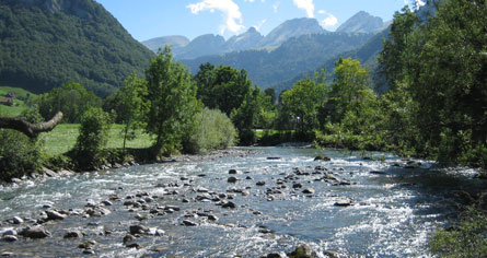
The Swiss rivers are highly beautiful and create a scenic landscape. The most important and longest river in Europe, The Rhine runs though Switzerland. The rivers of Switzerland include the Rhine, the Rhone, the Aare, the Inn, the Thur and the Ticino. All these rivers lead to three different seas. The Rhine and its tributaries lead to the North Sea. The Rhone and the Ticino lead into the Mediterranean. The Inn drains into the Black Sea. All these rivers originate in the centre of Switzerland's Alps. All the major cities are situated by the rivers as they provided location for trade and defensive in the past.


Most of Switzerland's countryside is made up of lakes. Switzerland has a large amount of small and large lakes. Lake Geneva and Lake Constance are the two most extensive lakes in this country. Both of these lakes are shared with the neighbouring countries. There are more than 1500 lakes in Switzerland containing around 6% of Europe's fresh water stocks Recently researchers found four giant craters in Switzerland's largest lake, Lake Neuchatel. The biggest crater is 160 meters wide and almost 100 feet deep. Researchers think that erupting ground water caused these to form. The pits are among the largest and deepest pockmarks to be found in Earth's lakes.


Friday 4 September 2015

Introduction and climate

My name is Ella and I am writing this blog on the geography of Switzerland. I chose this topic to discuss as I am interested in finding out more about this country from where I get my surname. I will categorise my blog into the different aspects of the physical geography of this country.


Switzerland is situated in the centre of west Europe and is home to the Alps. It is bordered by Germany, Italy, Austria and France. While sixty per cent of the country is alpine region the another is 30% hills and relatively flat valleys carved by glaciers called "Mittelland". The remaining 10% is made up of older mountain called Jura. 

The climate in this country is moderate with no excessive heat, cold or humidity. In the west, winds bring a lot of moisture into the country and cause rainfall. There is a continental climate with lower temperatures and less precipitation compared the west. The Alps act as an climate divide. South of the Alps there is a Mediterranean climate with higher temperatures but also a lot of rainfall. Overall the hottest months are July and August. Those visiting Switzerland for a skiing trip should visit during the months of December to April when the snow is good on the Alps. Summer is supposed to be warm and dry with maximum temperature up to 35 degrees Celsius. The temperature in winter will drop significantly to below zero everywhere in Switzerland.